WATERSHED RESOURCES REGISTRY
The Maryland Department of Transportation State Highway Administration (MDOT SHA) is part of a Technical Advisory Committee that developed the
Watershed Resources Registry, an online Geographic Information System (GIS) tool that identifies opportunities to protect, restore and conserve wetland, riparian and upland areas and improve stormwater management. The tool scores locations on a scale of one to five stars based on features that benefit restoration and preservation. Local, State and federal agencies, as well as other stakeholders, including the public, can use the interactive features to produce site maps that characterize and prioritize locations by these features. Potential uses include regulatory mitigation, restoration, enhancement, incorporation/consideration, avoidance and preservation.
The Technical Advisory Committee brings together several agencies whose contributions promote collaboration between environmental resource and regulatory programs through the registry. The site analysis scoring system has been developed through collaboration by this committee, whose members represent the same agencies that review projects, and provide permits and environmental approvals. Using this application puts us "all on the same page" before coordinating at the project level.
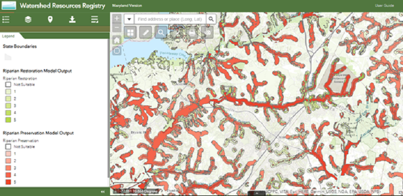
The maps below are examples of the
Maryland Registry's output. It shows the output from each of the preservation and restoration analysis models. The deepest colors represent the opportunity that would provide the most multi-resource benefits, “the most bang for your buck.”
In addition to showing analysis model outputs, the tool provides other data and site comparisons. You can find the best way to meet your needs while taking advantage of other watershed benefits at any given location. The registry illustrates potential mitigation sites for MDOT SHA planning studies and projects. MDOT SHA also used the registry to identify sites that support the Chesapeake Bay Total Maximum Daily Load.