Highway Performance Monitoring System (HPMS)
HPMS is a national road inventory database. It is the federal government’s official source of data on the performance, condition, use, extent and operating characteristics of the nation’s public road mileage as certified by the states' governors.
HPMS Products and Services
Mileage and Travel Summaries
Federal Highway Administration (FHWA) Links
How HPMS Data is Used
HPMS data is used as a planning tool:
- To assess the performance of the nation's highways
- To identify travel trends and future transportation forecasts
- For the annual FHWA highway statistics publications and the biennial Conditions and Performance Report to Congress on the State of the Nation's Highways
- For the apportionment of federal-aid highway funds to the states
How HPMS Data is Maintained
The Maryland Department of Transportation State Highway Administration (MDOTSHA) Data Services Engineering Division (DSED) reports annual HPMS data to the FHWA. To meet HPMS reporting requirements, DSED maintains a road inventory database and corresponding Geographical Information Systems (GIS) centerline data which represents all public road mileage in Maryland.
Changes to State-maintained highways are tracked internally throughout each year through highway construction projects and access permits issued by MDOT SHA and the Maryland Transportation Authority (MdTA).
Changes to roads maintained by county and municipal (local) government are identified through an annual road improvement reporting process based on the following schedule:
- September - MDOT SHA sends a road improvements package to the counties and municipalities requesting a list of updates and changes to their road system,
- December 1 - Deadline for counties and municipalities to return the improvements package
- November-April — Improvements and changes reported by counties and municipalities are field verified by MDOT SHA road inventory crews
- December-May — MDOT SHA technicians update the road inventory database, GIS centerline and Linear Referencing System (LRS) to reflect the reported changes; they prepare data for HPMS submission by June 15.
HPMS and GIS
As a result of the federal surface transportation funding program, HPMS GIS reporting requirements now include all publicly maintained roads and dual carriageways that represent divided highways. This requirement drives MDOT SHA to expand current business processes and to coordinate more closely with local jurisdictions.
-

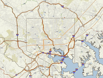
Baltimore City and Beltway
obtained through DSED eGIS web Application
MDOT SHA streamlines the HPMS reporting process for local governments by leading the One Maryland One Centerline (OMOC) project. The project's goal is to create a seamless, statewide GIS roadway centerline with multi-level linear referencing system (LRS) to serve State and local governmental agencies.
MDOT SHA is accomplishing three major goals for enhancing the statewide road centerline dataset:
- Meeting MAP-21 GIS reporting requirements for the HPMS submission
- Migrating the MDOT SHA Local Road Improvement Process from a paper process to digital leveraging the latest in GIS technology
- Migrating the MDOT SHA Local Road Improvement Process from a paper process to digital leveraging the latest in GIS technology